Dola KoyaKoya
Hiking the Haunted Mountain of Alor IslandDola Koyakoya: Hiking the Haunted Mountain of Alor Island
When I was planning my trip to Alor Island, I noticed Dola Koyakoya, a large mountain on the eastern end of the island, and became inspired to climb it. After a lot of Googling, the only thing I came up with was a few scant statistics, but no real idea of what it’s like to climb. My article will change this.
My adventure began while still at my friend Tim’s house in Bali. We were hanging out one evening on the porch with a friend of his, who we called Martin Timor, because Tim thought that he was from Timor island. Tim had been calling him this for many years, so the poor guy must’ve been a bit confused, because when I asked him it turned out he was from Flores. Anyway, Martin had spent considerable time on Alor island, so I quizzed him about the possibility of climbing Dola Koya Koya. “Oh, the locals don’t climb that mountain,” he said. “Why, is it really steep?” I asked. “No no, it’s an okay climb. But it’s haunted. The locals say there are ghosts living there.” Haunted? This just made me even more determined to give it a try.
Alor island is just a 40 minutes flight from Kupang with Wings Air.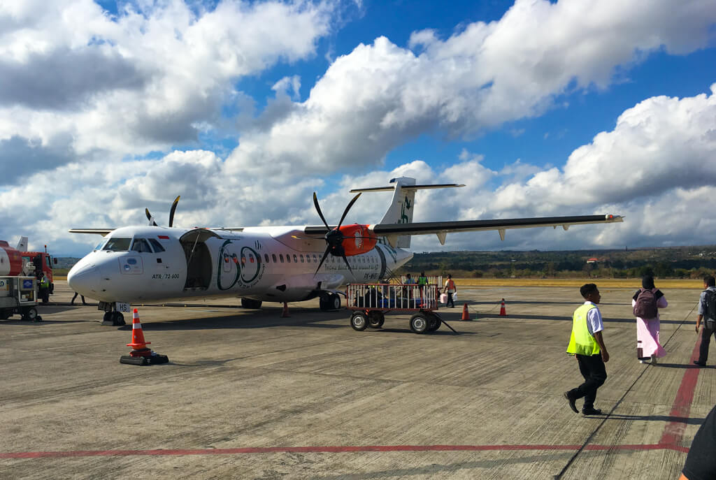
After we arrived on Alor Island, I asked our Couchsurfing host, who also told me that no one really climbs Dola Koyakoya, but wasn’t aware of any ghosts. We stayed in Kalabahi, the capital of Alor, about three hours drive from the mountain and rented possibly the shittest bikes I’ve ever ridden in my life from some acquaintances of Martin’s. Mine had no wing mirrors and riding back from visiting a tribal village in the dark the first evening, I realised that it had no lights either! The next day we complained and they fixed the lights.
Kalabahi is a non-descript Indonesian town with a few restaurants (bakso or mi goreng anyone?), a local market and thousands and thousands of children! We arrived just before Indonesian Independence Day and on our first day there was a huge parade made up mainly of schoolchildren, all dressed in colourful costumes or uniforms, playing music, dancing and in some cases following brightly decorated floats. We watched in awe for over two hours as they all passed. The other thing that impressed me was the last “float” in the parade – a small rubbish lorry with people clearing up the food wrappers and water bottles left by those in front. To see such care for the environment is a refreshing change in South East Asia and especially unusual in a location as remote as Alor.
The Independence Day parade passes through the main street of Kalabahi.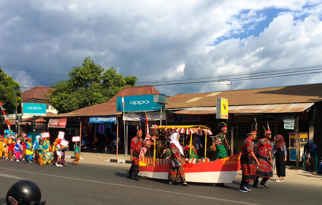
Stocking up on nutritious snacks for hiking Dola Koyakoya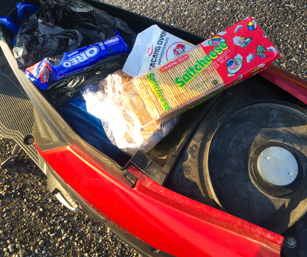
I stocked up on provisions – plenty of water and some snacks – and was ready for an early start to the mountain on our final full day on Alor. Tim, who’s not such a hiker, decided to explore the area surrounding Kalabahi instead, so I would be hiking alone. Although he was a bit concerned. “I can’t let you go alone,” he said, “what if your bike gets a puncture? You don’t speak Bahasa, you’ll be completely stuck.” I assured him that I would manage.
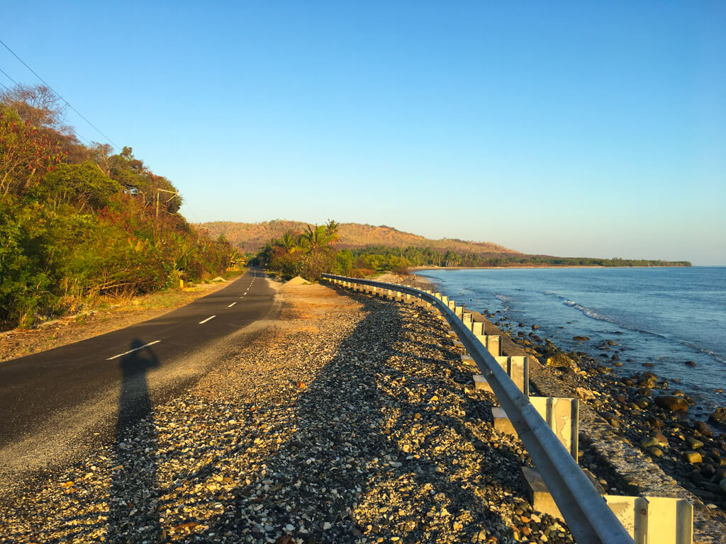
The next morning, I got up at 6am and headed out east on my bike before the sun rose. The road was sealed and surprisingly smooth and I made good time, but the air was cold and I shivered in my light summer clothes. The road hugged the north coast of Alor, with jungle to the right and, as dawn broke, beautiful views of the sun rising over the Banda sea to my left. People on Alor are very friendly towards foreigners and quite curious, as the island receives relatively few tourists. As the sun rose higher and villages burst into life, children waved and called out to me from the side of the road as I sailed through on my bike, enjoying the warm Indonesian sunshine on my back.
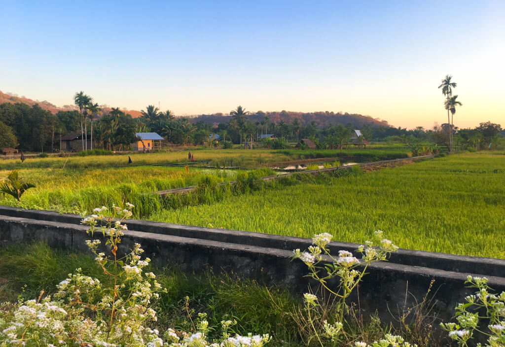
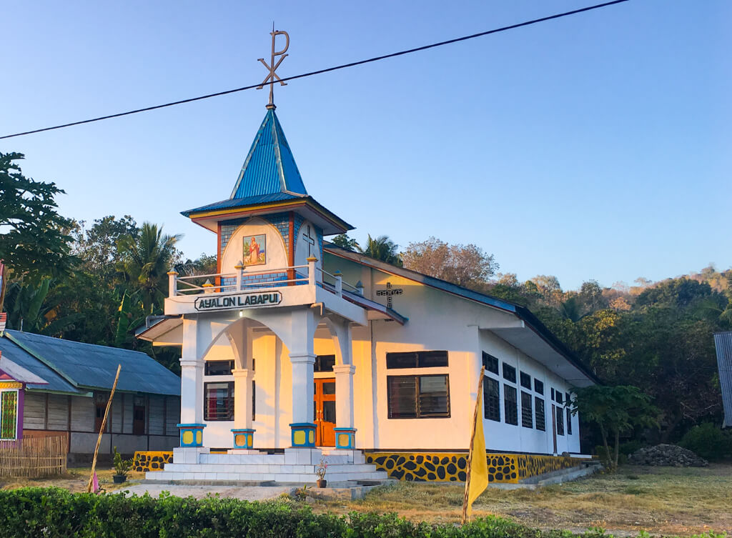
The sun rises to the east over the Banda Sea. Looking back along the road in the direction of Kalabahi during a snack break. At one point the rode snaked inland past a village with brilliant green rice paddies. Alor is a very Christian island and I passed many colourful churches.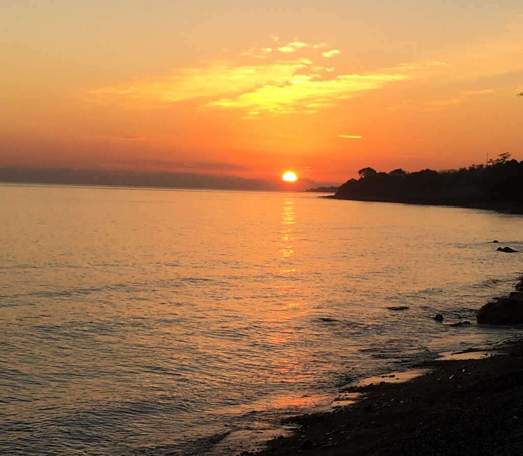
After a couple of hours, the road turned south and zigzagged its way up into the mountains. After a steep climb, I started to run out of fuel and stopped to buy a bottle of ‘benzine’ from a local lady on the side of the road. One of the great things about Indonesia is that you can find fuel almost everywhere, so there is little danger of getting stuck. Online maps do not show the trails around Dola Koyakoya, just the peak, so knowing where to stop the bike was tricky. Eventually, I reached the closest stretch of road shown on the map and started looking for an access point to begin hiking the mountain.
I passed a few houses with no obvious paths or signs indicating that they may be the starting point for hiking the mountain, so I continued on and asked a few locals on the way. No one spoke any English out here, so asking basically consisted of saying Dola Koyakoya as clearly as possible and them pointing in various (sometimes contradictory) directions. Later I realised that this is because there are several small paths leading up to the mountain, so probably all of their directions were correct. This is not Mt. Fatuleu, the mountain Tim and I climbed in West Timor, with it’s clearly marked entrance and path built specifically for hikers (although I had a LOT of fun climbing that one too and would highly recommend it). On Dola Koyakoya, all the paths were for local herders who graze animals on the slopes of the mountain. Eventually, I realised I’d gone too far and ended up back at the group of houses, where I finally found a sign that I had missed on my first pass.
The road begins to climb inland towards the base of Dola Koyakoya. The sign at the access point to Dola Koyakoya. Once I saw it I didn’t know how I’d missed it the first time.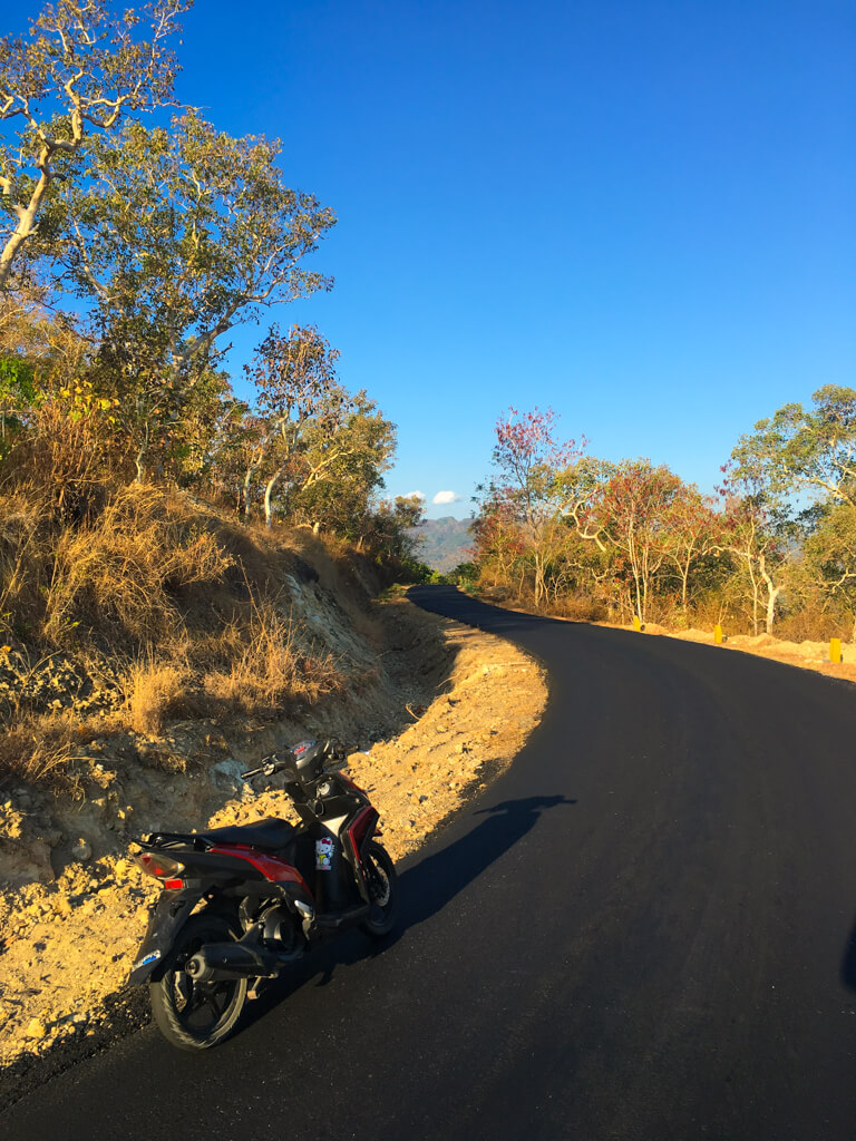
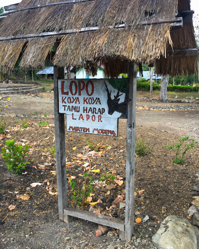
The sign appeared to have been erected by an enterprising family rather than an official tourist organisation and no one was to be seen. I called out and a friendly teenage boy appeared who spoke a few words of English, so I asked where I could leave my bike and directions for climbing the mountain. He let me park the bike in a shed (to keep it safe, maybe from the ghosts…) and told me to follow a path to the left of the house and then take the second path to the right up towards the mountain. So far so simple. During the first few minutes of my walk, I passed a couple of other locals who pointed me variously in the vague direction of the mountain and then I was on my own. I would not see another soul for the next eight hours.
The various paths I followed wound through agricultural land planted with a variety of crops and were much more complicated than the boy at the start had suggested. I just kept heading in the general direction of the mountain and figured that at some point the paths would thin out and hopefully I’d be left on the correct one for the summit. If only! Eventually they did thin out and I was left with – nothing! The path I had been on simply faded away as the agricultural land gave way to an increasingly steep hillside covered in tall grass, the kind that can easily give papercuts.
The beginning of the path up Dola Koyakoya. The path fades and becomes a steep scramble through long grass.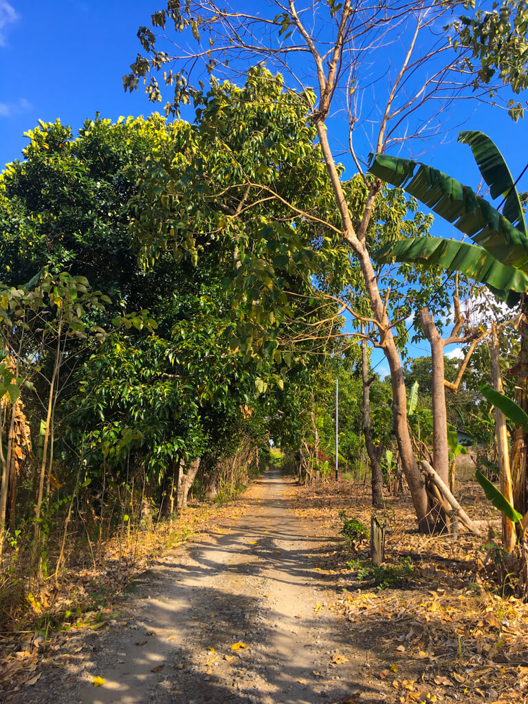
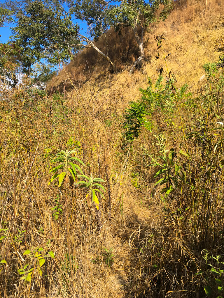
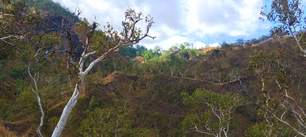
I thought about going back and looking for another path, but I wasn’t sure which way to go to find one by this stage and I figured that, if I could just climb the hill in front of me, I would have a clear view of the other side and be able to see where the real path up the mountain was. The climb was tricky, but I grew up in the Scottish countryside and am quite sure-footed. It was, however, very slow, as I had to be very careful not to slip, which, on the steeper parts, involved finding as many handholds as possible, as well as footholds. I was also looking out for snakes, as this kind of tall grass seemed like the perfect habitat for them. And of course, when I eventually reached the top of the hill, there was another slope in front of me. After investing this much effort, I didn’t feel like giving up, so I climbed this hill as well, and then another, until eventually I reached the top of a ridge. Before me was a beautiful valley with Dola Koyakoya rising into the mist on the opposite side. Long sloping shoulders wound gradually upwards towards the mountain on both sides of the valley. What I could not see was a path!
Taking the right hand shoulder would’ve required descending again before climbing back up, so with no paths visible anywhere, I gritted my teeth and continued my slow ascent through the long grass up the left hand shoulder. The climb went on and on, in some places steeper and more difficult, forcing me to use my hands to hang on to clumps of dry grass, and in others flatter and easier, until eventually, after another hour or so, I finally found the beginning of a path, probably made by deer.
Eventually I found the beginnings of a narrow path. The path ran back and forth along the rugged ridges of the lower slopes of Dola Koyakoya.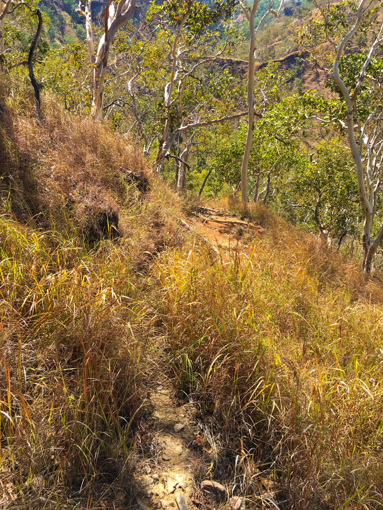
I followed the path along various ridges towards Dola Koyakoya until eventually it joined a bigger path and finally I came across a singpost. I have never been so happy to see something man made in nature in all my life! However, apart from indicating that I was now probably on the right path, it actually told me little about which direction to take. So I just chose the direction leading up towards the mountain and continued walking. By this point, the altitude was such that the long grass began to give way to rockier ground and exposed earth. The climb was steep, but I was relatively fit. The difficulty came from the smooth soles of my Converse shoes, which struggled to find a grip on the loose soil and pebbles, making progress painstakingly slow.
A singpost. Entirely in Bahasa Indonesian, but at least it meant that people actually came here.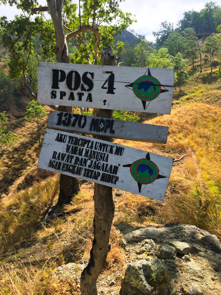
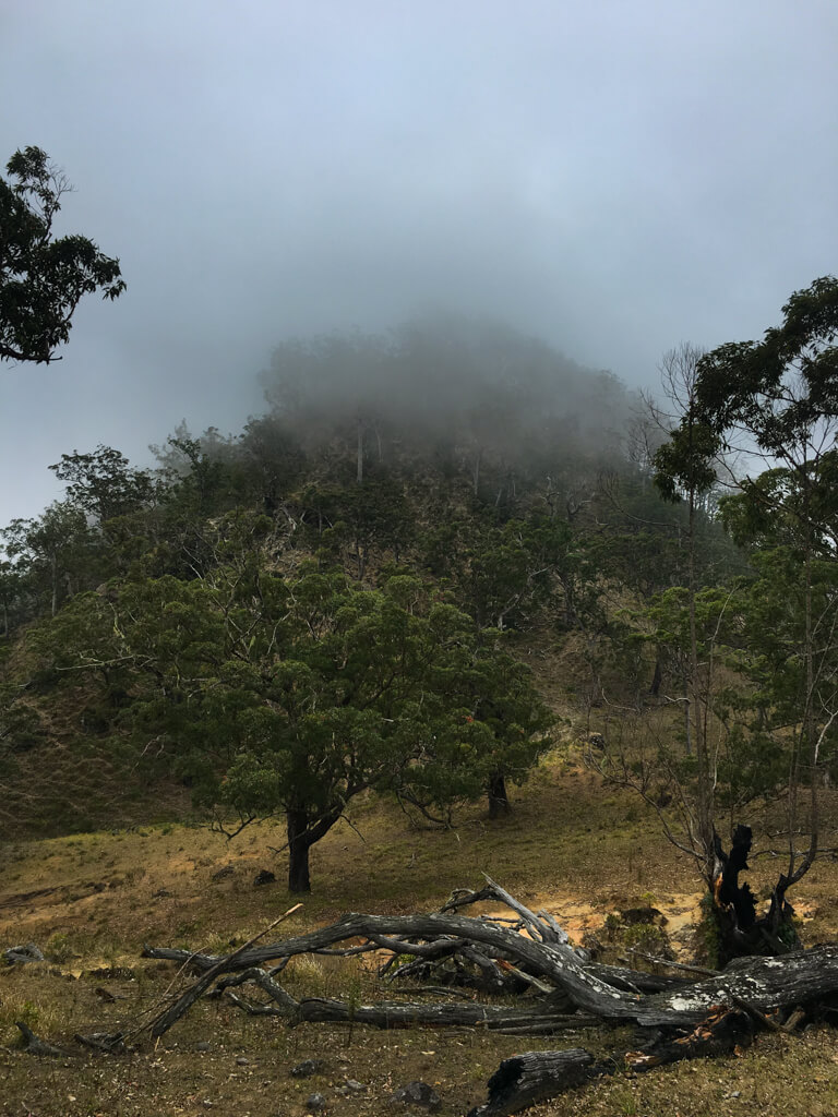
Eventually, after quite a climb, I arrived at a plateau. There was a rather odd-looking flag planted in the ground in what looked like it had been a makeshift campsite. The path continued to the right, which, from Maps.Me’s offline maps on my mobile, I could see was also the direction of the summit, so I continued in that direction. I walked for another half an hour or so, the path rising gradually, when I saw the final ascent looming out of the mist in front of me. I was quite relieved by this, because I was beginning to get concerned about the time – I had no idea what the path down would be like (or even if it existed!) and hiking down in the dark was really not appealing.
A rather odd flag hanging at a makeshift campsite. I never did discover what it meant. The final ascent looms out of the mist in front of me.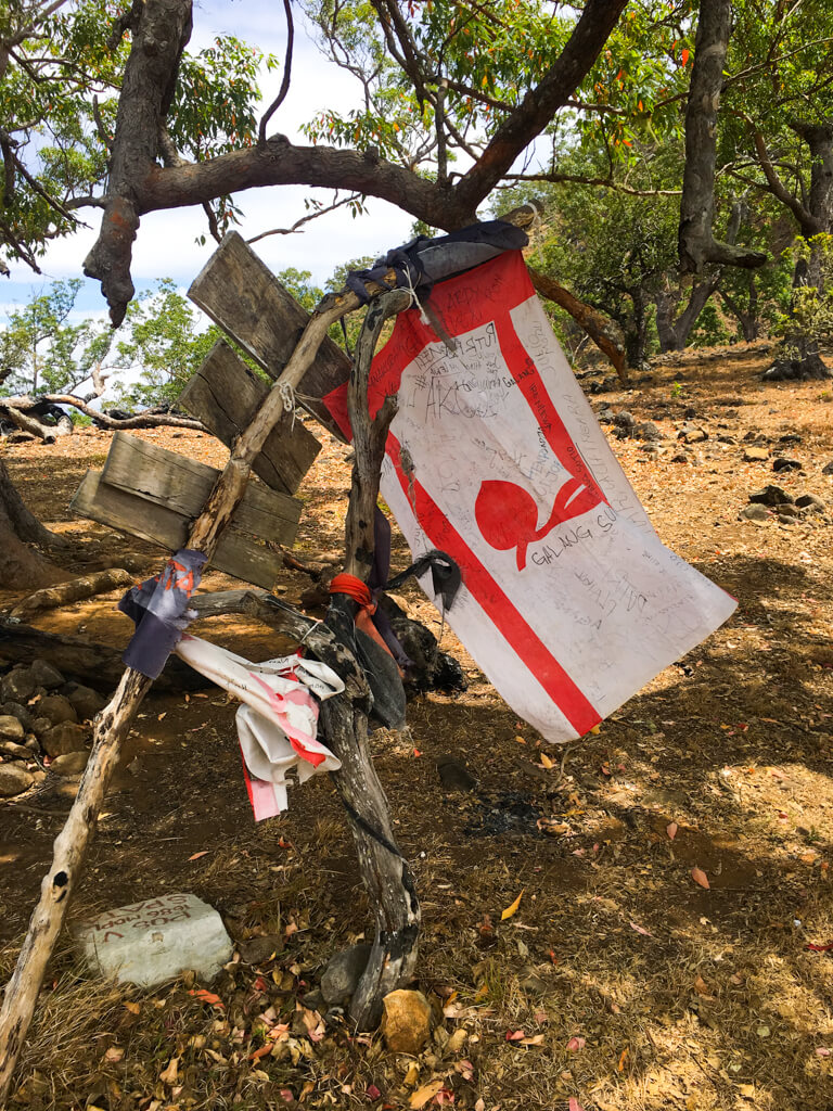
There was a slight dip just before the final ascent and it was here that I witnessed the most beautiful thing of my whole Alor trip – two stags fighting, antlers locked, pushing each other with all their might. Nearby, a couple of does looked on (I guess they were each rooting for their favourite bloke). I moved silently and stayed a respectful distance. The spectacle lasted for maybe ten minutes and one of the stags obviously had the upper hand. They would lock antlers for minutes on end, the weaker of the two being pushed slowly backwards by the other, often around in circles. The power they must’ve had was impressive. Then they would move apart and clash again.
At one point, the stags came a bit too close for comfort and I quietly backed off – I’m not sure how dangerous stags are to humans, but I didn’t want to find out! Eventually, the weaker of the two had had enough and backed away, finally disappearing into the mist. The victor watched him retreat and then strutted away, flanked by the two females. It’s just a pity that my iPhone camera was nowhere near good enough to capture the moment.
By this point, I had lost the path again and it was quite misty. I scrambled up what I hoped was the final stretch, hanging onto various shrubs (the non-spikey ones) so as not to slide all the way back to the bottom if my Converses lost their grip on the loose stones and dirt. It was hard work and treacherous. Eventually, I reached the top of the slope, only to find that there was a narrow ridge, with the summit presumably on the other side, and no path. There was an almost vertical drop down one side, and down the other a slightly gentler, but none-the-less steep-enough-to-break-a-leg slope. I scrambled across the first part before stopping to ask myself what I was doing. Did I want to reach the top? Yes, of course. Did I want it enough to die in the attempt? Definitely not. And had I already experienced 95% of what the hike had to offer without those final 50m or so? Yes, definitely. And so it was that I climbed to within a few meters of the top of Dola Koyakoya. I never did actually reach the summit.
Me at the highest point I reached on Dola Koyakoya.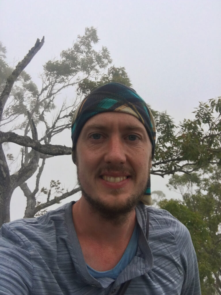
I’m pretty sure that I missed the path at the very end. Somewhere, possible near where the stags had clashed, there is probably a path that would’ve taken me to the summit. I backtracked a little and searched for it, but without success. Time was pressing on and I was concerned about making it back to the bike before nightfall, so I gave up the search and began retracing my steps away from the summit. I walked along the edge of the plateau, roughly retracing the path I had taken on my ascent, but then lost my way for a while. I had actually placed a marker on Maps.Me just after arriving on the plateau, to help me find my way back, but the location was not completely accurate. It’s amazing how everything can look the same out in the wild, especially when it’s misty.
After a while, I came across the flag that I’d noticed on the way up and then located the trail back down the mountain side. That stretch of path was the steepest I had come up, apart from the final ascent to the summit, and descending without slipping took all my concentration and a very long time. Eventually, the ground leveled out again and I arrived back at the sign post. From here, I knew that I couldn’t simply retrace my steps, because then I would end up descending the steep grassy slopes that I had come up that morning and there was no way I would manage that before nightfall.
The view over the slopes of Dola Koyakoya.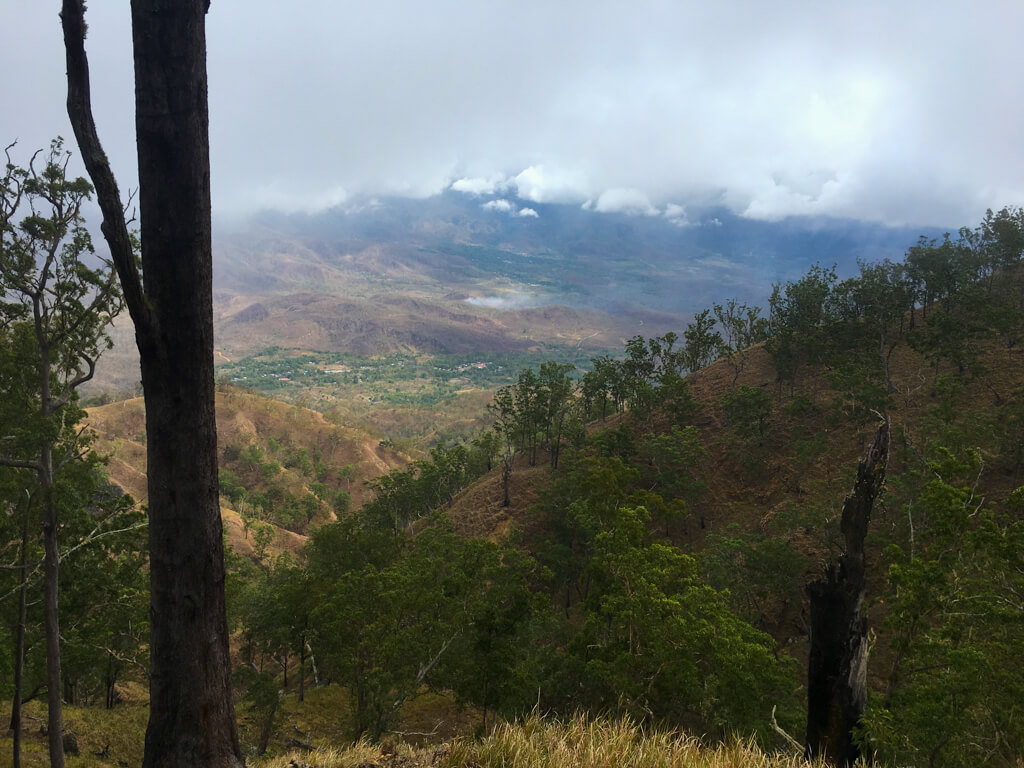
I continued along the path, which grew increasingly narrow, until I came to a fork that I hadn’t noticed on the way up. The new path was so narrow that it was almost buried by the grass growing on either side (maybe due to the time of year), which is probably why I hadn’t noticed it before. I had no idea where it would take me, but it was heading in the general direction of the houses at the base of the mountain and it wasn’t likely to be much worse than the way I’d come up, so I took it. It continued for a long time, descending only very gently, along the other flank of the mountain from the one I’d come up, zigzagging back and forth along various ridges. Eventually, I realised that the houses were now quite close, but I still had a lot of altitude to lose. It suddenly crossed my mind that I might be heading for a cliff and a dead end. Maybe this was just an animal track after all and not a path used by humans?
The narrow path was almost invisible amongst the long grass.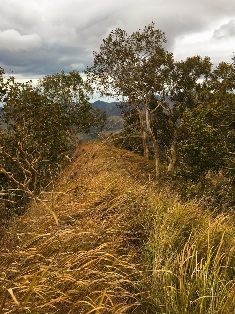
The view was beautiful despite the dodgy weather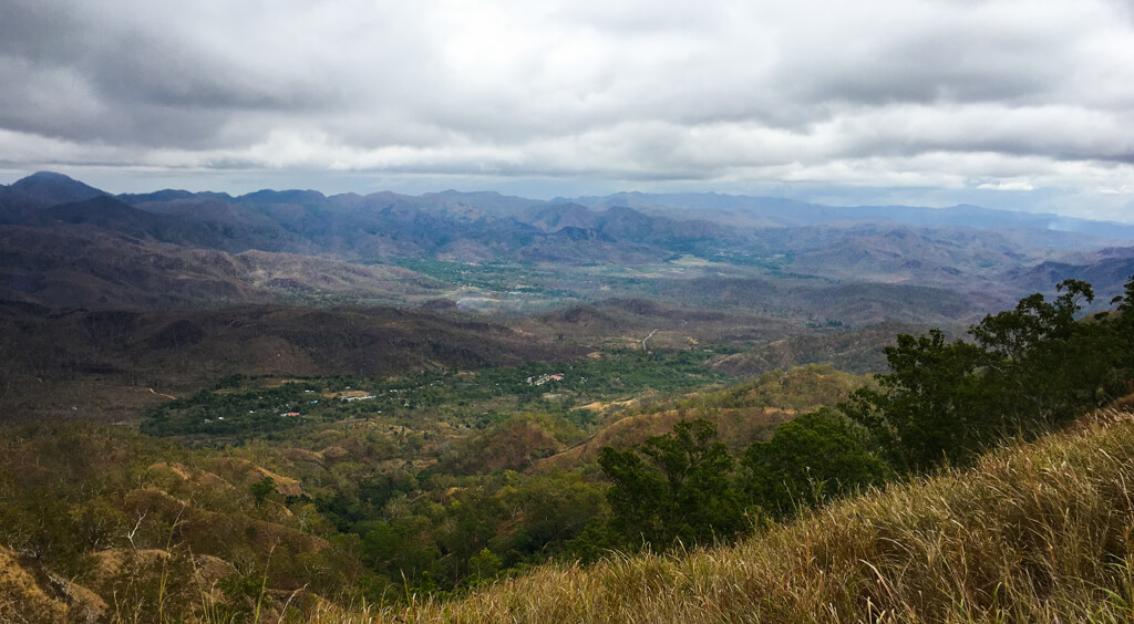
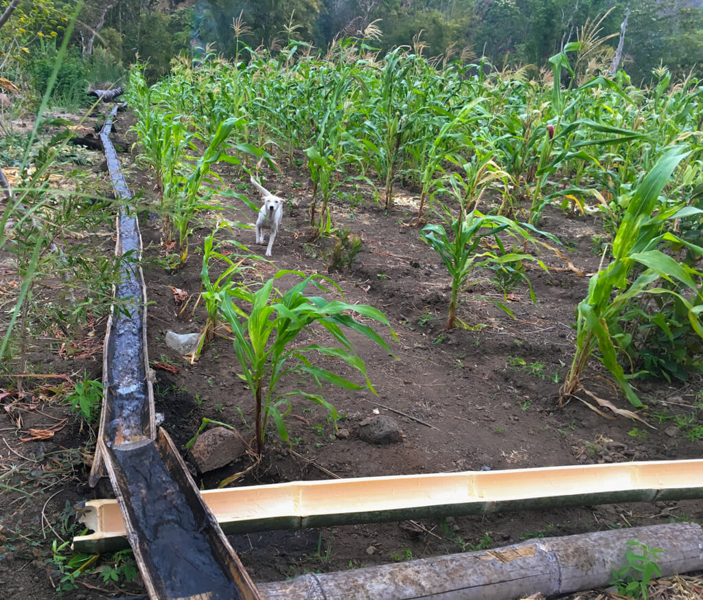
Luckily, my fears were unfounded and the path finally began a steep descent. I was overjoyed. By this point, it was late afternoon and the weather had changed. By the time I’d descended the steepest section, the sky was gray and it had started to rain. The path gradually leveled out and the long grass gave way to plantations of trees, some with plastic irrigation hoses, and even a shed. Finally, as the sky opened and it began to tip with rain, I made it back to the road. On the edge of the road was a house with a wooden canopy next to it and an Indonesian family sheltering from the rain. I invited myself in with a few gestures and they welcomed me with a few English words. They looked a bit surprised to see an ill-prepared foreign hiker suddenly appear out of their plantation!
Maize left to dry in the open air. Back from the wilderness. Luckily the dog was friendly.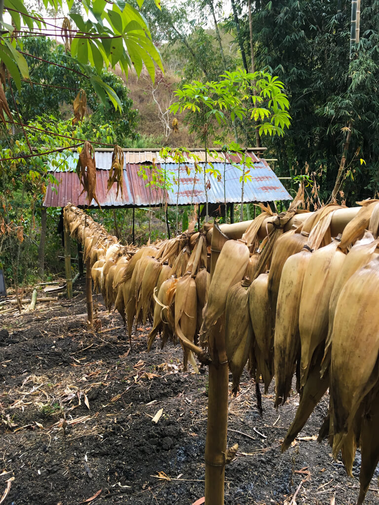
After the rain subsided, I walked the last kilometer or so back to where I’d left the bike. The boy who’d shown me where to leave it was nowhere to be seen, but I called out when I entered the building and a woman appeared. She didn’t speak English, but I gave her 10,000 rupiah (€0.59/$0.69) as a thank you and got back on the road. As I headed back towards the coast, the rain came and went, and at some points I was shivering with cold as the wind from the bike lashed it against my skin. Eventually, I descended the steep hill down to the coast and suddenly the rain was gone and the temperature was several degrees warmer – I couldn’t believe what a huge difference the altitude made. I dried off and continued on my way, but the adventure wasn’t quite over yet.
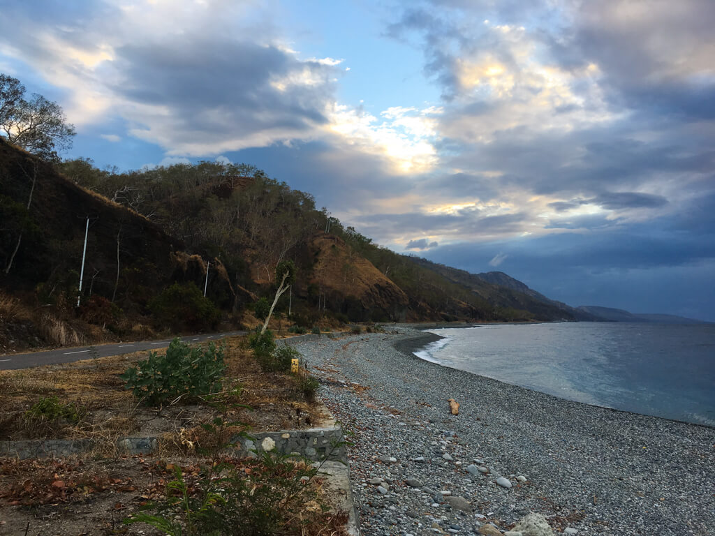
Riding back down to the coast. The evening ride back along the coast was every bit as beautiful as the morning one.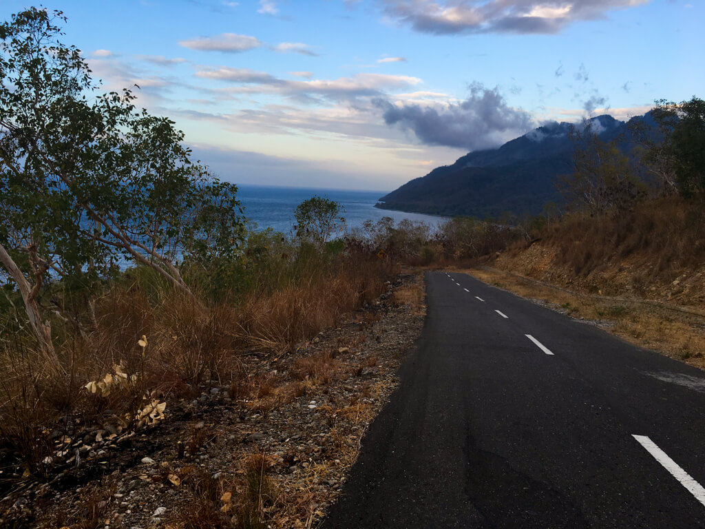
With about an hour to go to Kalabahi, my piece-of-junk bike suddenly started making a weird noise. I slowed down, but it continued, so I stopped, checked the tyres and found that the back one way flat – I had a puncture. I think Tim had jinxed me the day before when he said, “What if you get a puncture!” A man saw me examining the bike tyre with the light of my phone and came over to have a look. I pointed at it and, after taking a look, he pointed back in the direction I’d come from, and then indicated the right hand side. He even managed to remember enough English to say, “10 minutes, fix bike.”
I rode back at a snail’s pace and, sure enough, found a group of boys hanging out in front of a little shed with pieces of bikes everywhere. Between them, they knew a few words of English and they were excited to take selfies with a foreigner. We even ended up drinking together – some home brewed alcohol from a plastic water bottle. Originally, they wanted to change something (I think probably the inner tube, it was difficult to know) for 170,000 rupiah (€10/$12). I said, “no no, rental bike,” and mimed giving it back to someone until they eventually understood (travel has really improved my acting skills!). So they just patched it up for 10,000 rupiah (€0.59/$0.69) and I continued on my way.
The boys at the bike shop were a rowdy bunch. Notice the plastic bottle of alcohol held aloft by the boy at the back.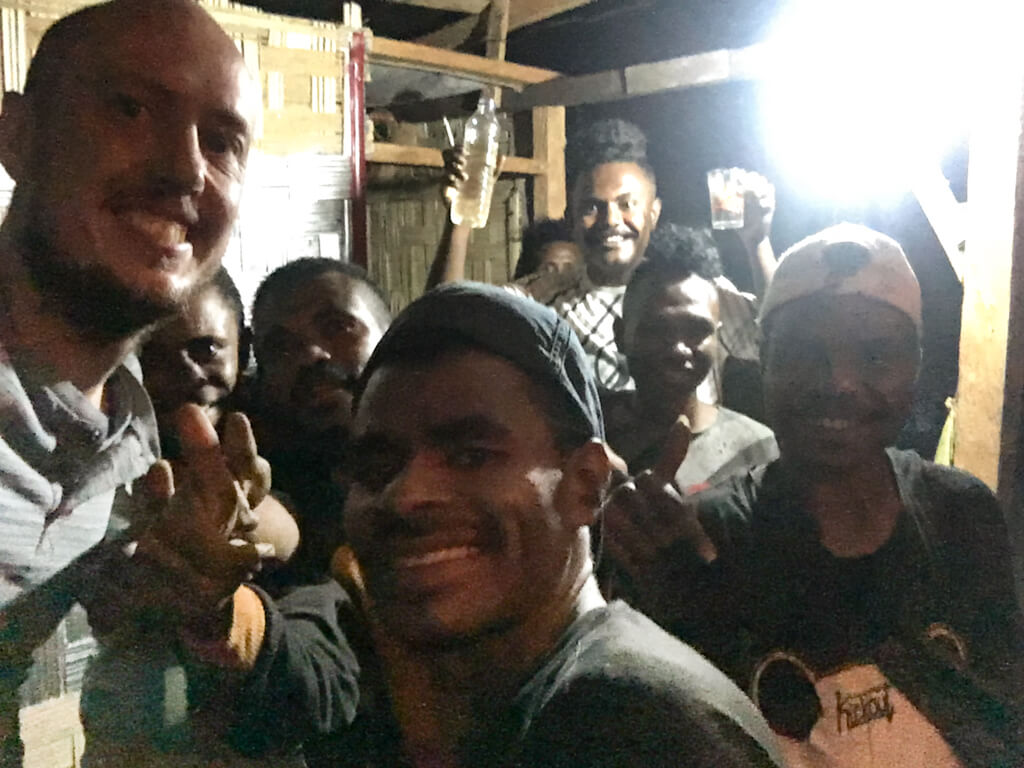
By this point, Tim had called and told me he was hanging out with the local tribe we’d visited on the first day and putting his Bahasa skills to good use building a relationship with them. I arrived, about half an hour later, to find an amazing hot meal of local delicacies awaiting me. The others had already eaten, but had saved me a big portion. Tim and the tribal chief chatted while I relaxed. I was exhausted from my adventure, but happy, despite not quite having made it to the summit. It had been an epic day.
The next day, after enjoying a good breakfast with coffee, we hung out with the local tribe and had fun dressing up in their traditional costumes, before heading to Alor ferry terminal and catching a ferry back to Kupang in West Timor. We bought VIP tickets and so had beds for the overnight journey. That evening, we got talking with another foreign traveller who was taking the same ferry with his motorbike and a young Indonesian guy. We weren’t too clear on their relationship, but the next morning when we were almost at Kupang, I awoke to find the Indonesian guy massaging my bare leg (I slept fully dressed, but was wearing shorts). “I can give you full body massage,” he told me. I pulled my leg away and declined his offer. That’s one adventure I’d rather not have!
Are you sure that’s a bit enough knife for the task, chief?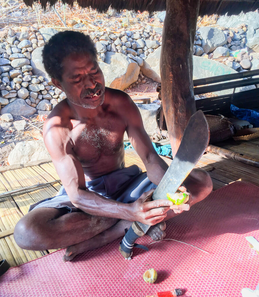
Don’t mess!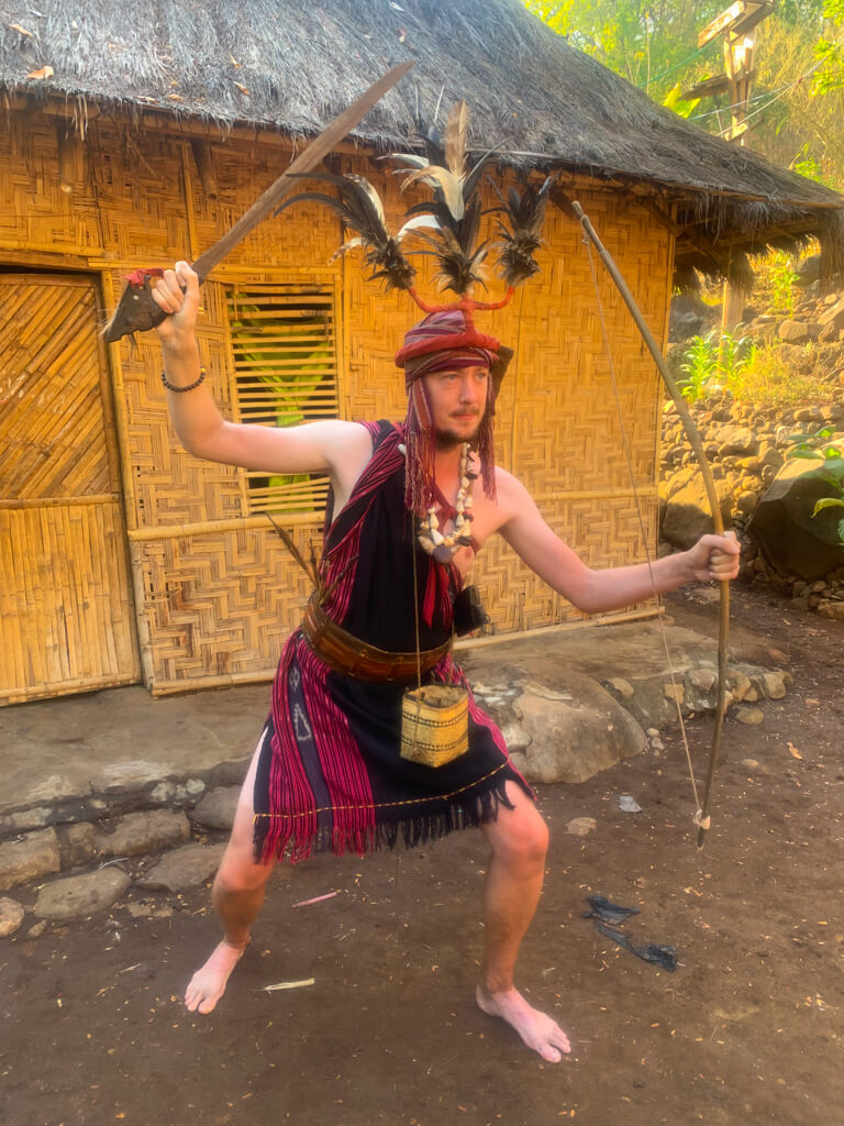
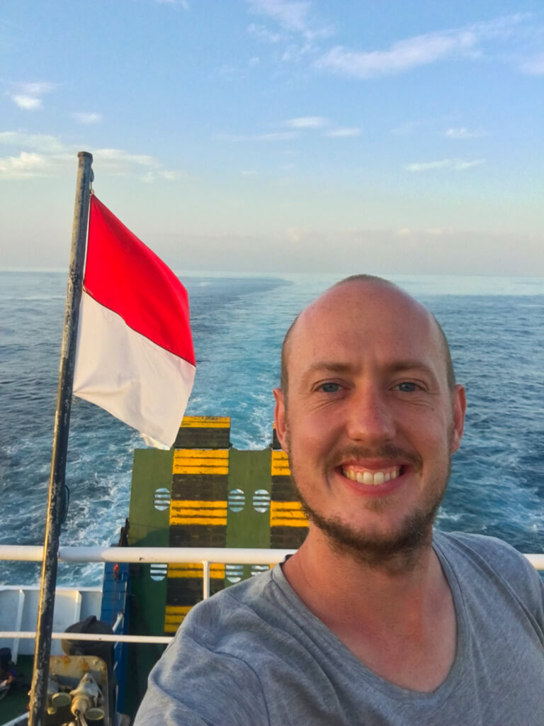
Scottish clan visits Indonesian tribe! Enjoying the evening breeze on the ferry from Alor back to Kupang. Arriving at the port of Kupang at dawn.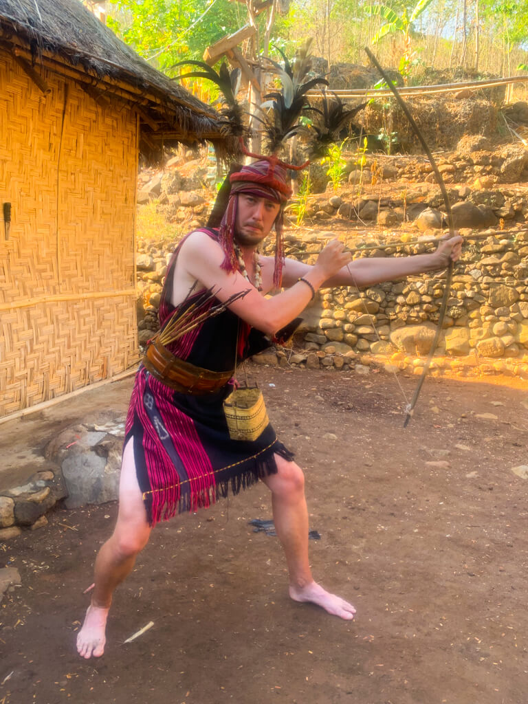
Continue the Journey
After arriving back in West Timor, Tim and I continued our adventures by visiting the local beaches, the tribal village of Tamkesi, and climbing West Timor’s most famous mountain on Indonesian Independence Day. You can read all about it here:
West Timor: Crystal Pools and the Best Pork in the World
West Timor: The Terrifying Ascent of Mt. Fatuleu
West Timor: A Night in Tamkesi Traditional Village
I loved Indonesia and also spent time in Jakarta, visiting some off-the-beaten-track places, such as Sunda Kelapa harbour in Jakarta, and Couchsurfing in the Jayapura region of the fairytale land of West Papua. Check out these adventures here:
Sunda Kelapa Harbour: Exploring the Old Port of Industrial Jakarta
West Papua: The Lake Where Dreams Come True
Useful Tips
- The Bahasa (Indonesian) word for petrol is benzine. It’s (for some reason) either yellow or blue and is sold in plastic bottles by enterprising locals on the edge of the road throughout Alor. Prices are slightly higher than at the petrol stations in the cities, but at least you never run out of fuel.
- If you do decide to hike Dola Koyakoya without a guide, I would strongly suggest not to do it alone. Looking back, it could’ve been quite dangerous if I had injured myself or even if the rain had come in earlier than it did.
- Most of the hike is not particularly difficult, but it is long, so having a reasonable degree of fitness will certainly help.
- There aren’t any shops or restaurants near Dola Koyakoya, so make sure to take enough food and, especially, water for the hike.
- Wear decent footwear and, if possible, take waterproof clothing in case it rains. The weather can change very quickly here. Converses are definitely not recommended!
- When hiking in wilderness areas without paths, I use the offline maps of the Maps.Me mobile app and place frequent markers as I walk. This is very helpful if I get lost, as it creates a kind of breadcrumb trail to follow back to the starting point. I always carry a power bank to make sure I don’t run out of power. GPS positioning works even without mobile signal (as it relies on the GPS satellite network, which has global coverage), so it’s generally a very reliable approach, unless you are underground or in a building, in which case the signals can be blocked.
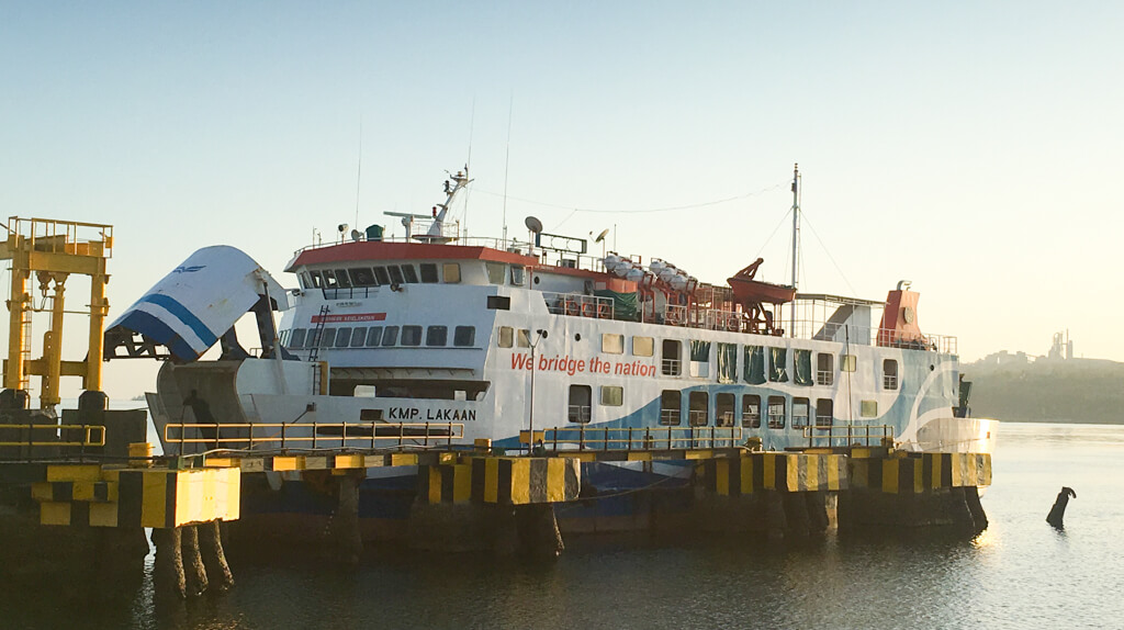
- The ferry from Alor island to Kupang departs daily and VIP tickets (with a bed) cost 170,000 rupiah (€10/$12). Cheaper non-VIP tickets are also available, but you may well be sleeping or even sitting on the floor, as the ferries get quite full. There are also daily departures from Kupang to Alor. The ferry terminal is marked on Google Maps as “Pelabuhan Kalabahi” at geographical coordinates -8.222031, 124.511793. The location on Maps.Me is incorrect. Tickets are available for purchase at the terminal and we had no trouble purchasing them on the day of travel. Ferries arrive at Kupang ferry terminal in West Timor.
- To reach Alor island, we flew from Kupang with Wings Air. The flight was about 40 minutes and cost 450,000 rupiah (€26/$31). Kupang is the capital of West Timor and has fligth connection to both Jakarta and Bali.
Recent Comments